The figures appear together on a metal plate set into a stone at the summit. One is the normal height used by Germany’s current height system; the other is an ellipsoidal height used in satellite positioning. The same spot, measured from two different reference surfaces.1
The mountain has not secretly grown another 45.83 metres. It has merely been assessed by two departments.
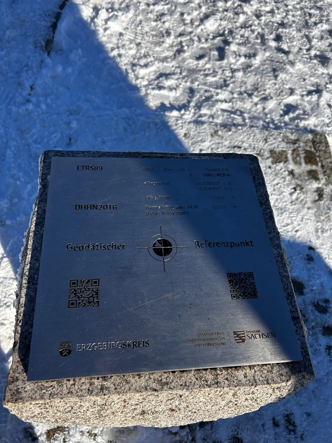
A QR code beneath the coordinates allows visitors to check the accuracy of their navigation devices. After climbing to the highest mountain in Saxony, one may therefore celebrate by discovering whether one’s telephone knows where it is.
This is modern geodesy: satellites, digital coordinates and a metal plate polished by weather and curious fingers.
01
The stone that moved
A few steps away stands its considerably older relative.
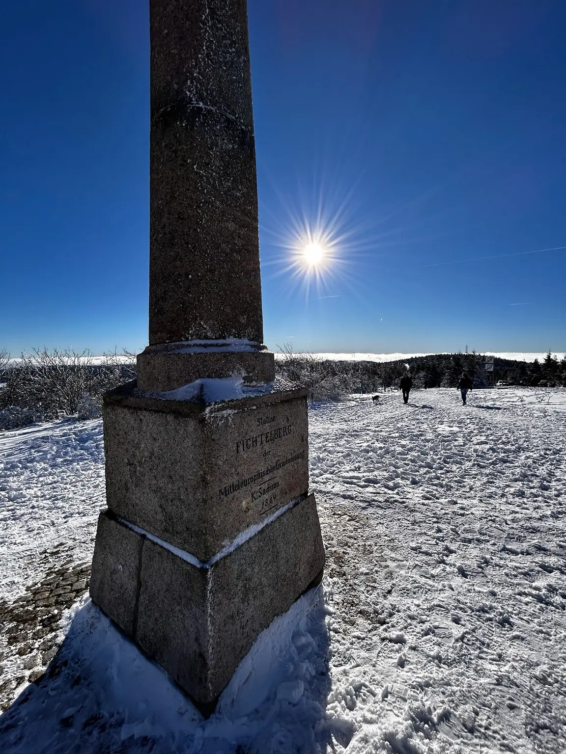
The stone column is easy to mistake for a minor monument of the sort erected whenever someone important once stood somewhere in a hat. Its inscription says otherwise:
Station Fichtelberg der Mitteleuropäischen Gradmessung. K. Sachsen. 1864.
It was Station No. 15 in the Royal Saxon triangulation.
Between 1862 and 1890, surveyors created a network of permanent measuring points across the Kingdom of Saxony. From prominent summits, angles were measured between distant stations, creating enormous triangles from which the landscape could be mapped.
The first-order stations formed part of a wider Central European project concerned with something even larger: establishing the size and shape of the Earth.
This was GPS before satellites, batteries and the reassuring blue dot. It required theodolites, clear sightlines, mathematics, formidable patience and—on the Fichtelberg—clothing chosen by someone who did not believe suffering improved accuracy.2
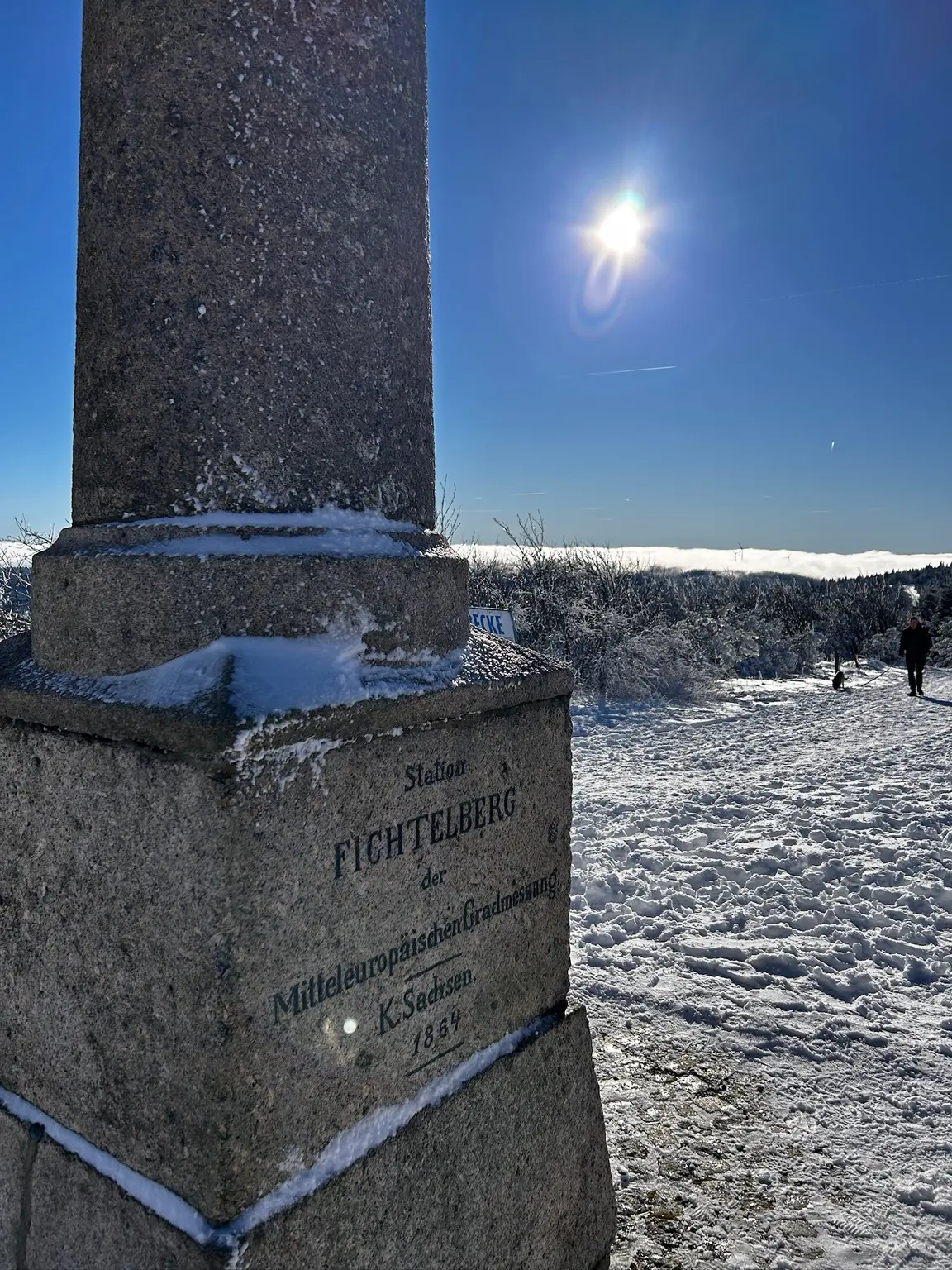
The column has survived the Kingdom of Saxony, two world wars, several versions of Germany and generations of visitors who came for the panorama without ever reading its inscription.
It has not, however, remained precisely where the surveyors put it.
In 1965 it was moved approximately eighty metres south to make way for a new Fichtelberghaus. There is something pleasingly human about moving a monument dedicated to exact positioning because it happens to be in the way.
02
Concrete, coffee and the GDR
The earlier Fichtelberghaus had burned down in February 1963. Heavy snow obstructed the road, firefighting equipment had to be taken up by cable car, and a hose laid from Oberwiesenthal froze at minus fifteen degrees. The building could not be saved.
Two years later, the GDR began its replacement. It opened in 1967 with a forty-two-metre observation tower, a self-service restaurant, a grill bar, a dance café and a conference salon. Together they could accommodate six hundred guests.
The Fichtelberg was the highest mountain in the GDR, so its summit was landscape, prestige project and public recreation ground at once. The building visible there today was later substantially reconstructed, but the displaced survey column remains—a small granite witness to the moment when nineteenth-century precision met twentieth-century concrete and was politely asked to shuffle south.3
People now reach the summit on foot, on skis, by bicycle or aboard Germany’s oldest aerial cableway, operating since 1924. On this winter day, the selected alpine discipline was sensible use of a motor car. The road up from Rittersgrün was steep, narrow in places and partly frozen. Heroism is an unreliable substitute for traction.
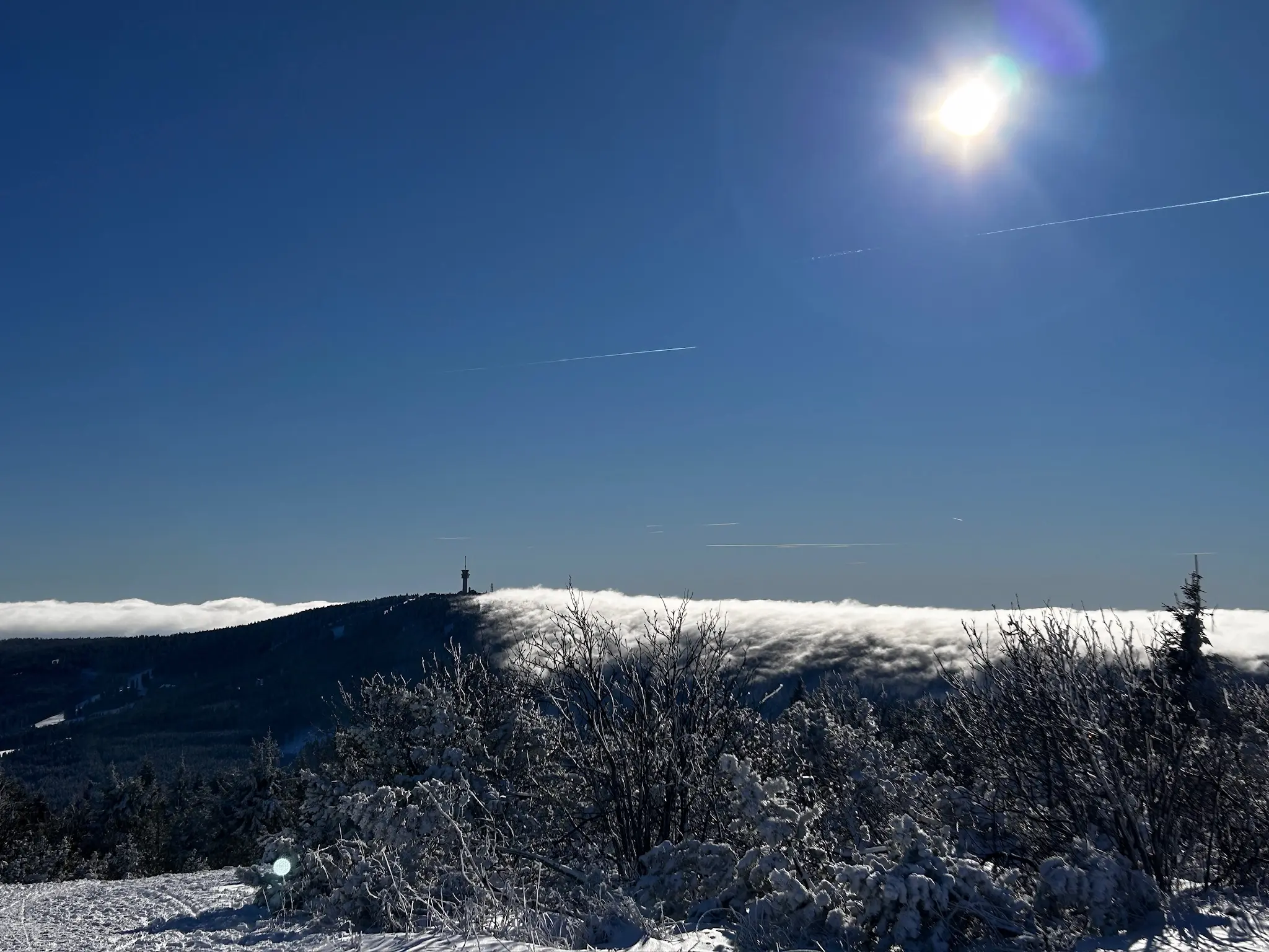
The higher the road climbed, the more the landscape opened.
Snow gathered on branches and along the verges. At the summit the wind howled across the plateau while the sun remained almost indecently cheerful. Beyond the ridge lay a white sea of cloud, with the higher ground rising from it in the distance.
It was the sort of view that makes people walk directly towards the edge, take several photographs and announce that they can see for miles.
They can.
They may simply be looking in the wrong direction.
03
Agnes, behind the fence
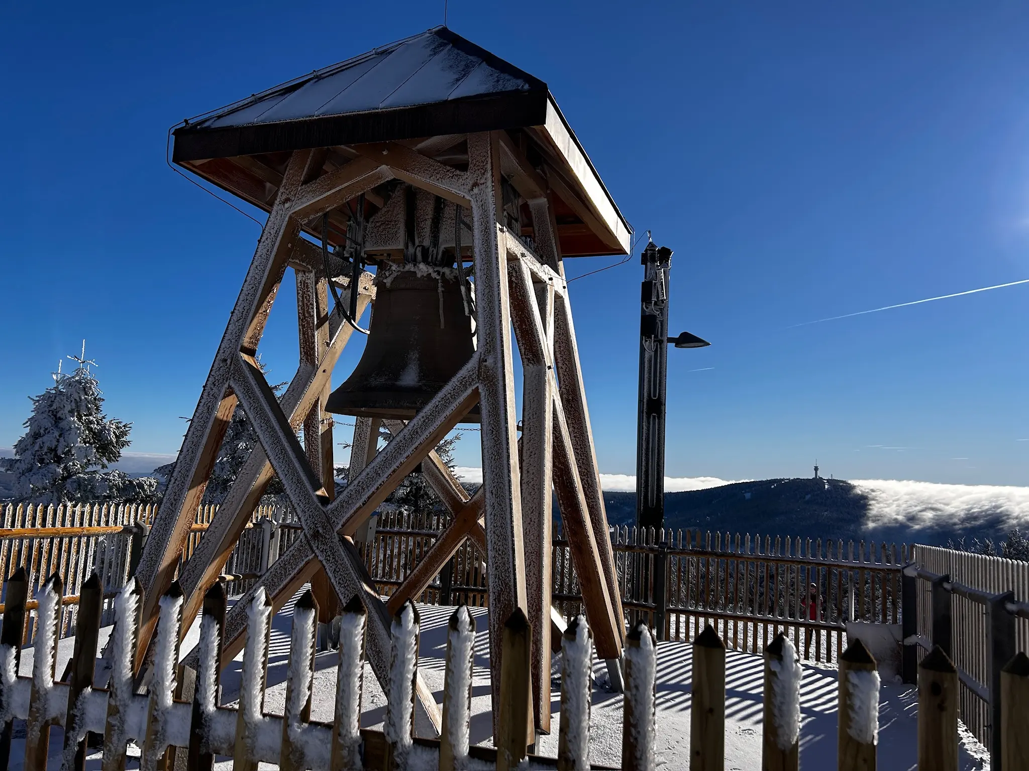
Behind a barrier stood something the winter had almost entirely claimed. Ice covered the wooden structure and hung in long teeth from its beams. Inside it was the shape of a bell, dark beneath the frost.
The photographs approached it from several angles, trying to catch the ice, the scale and the strange stillness of the object. None quite conveyed how imposing it felt when standing before it.
Cameras are very good at recording surfaces. Presence remains annoyingly analogue.
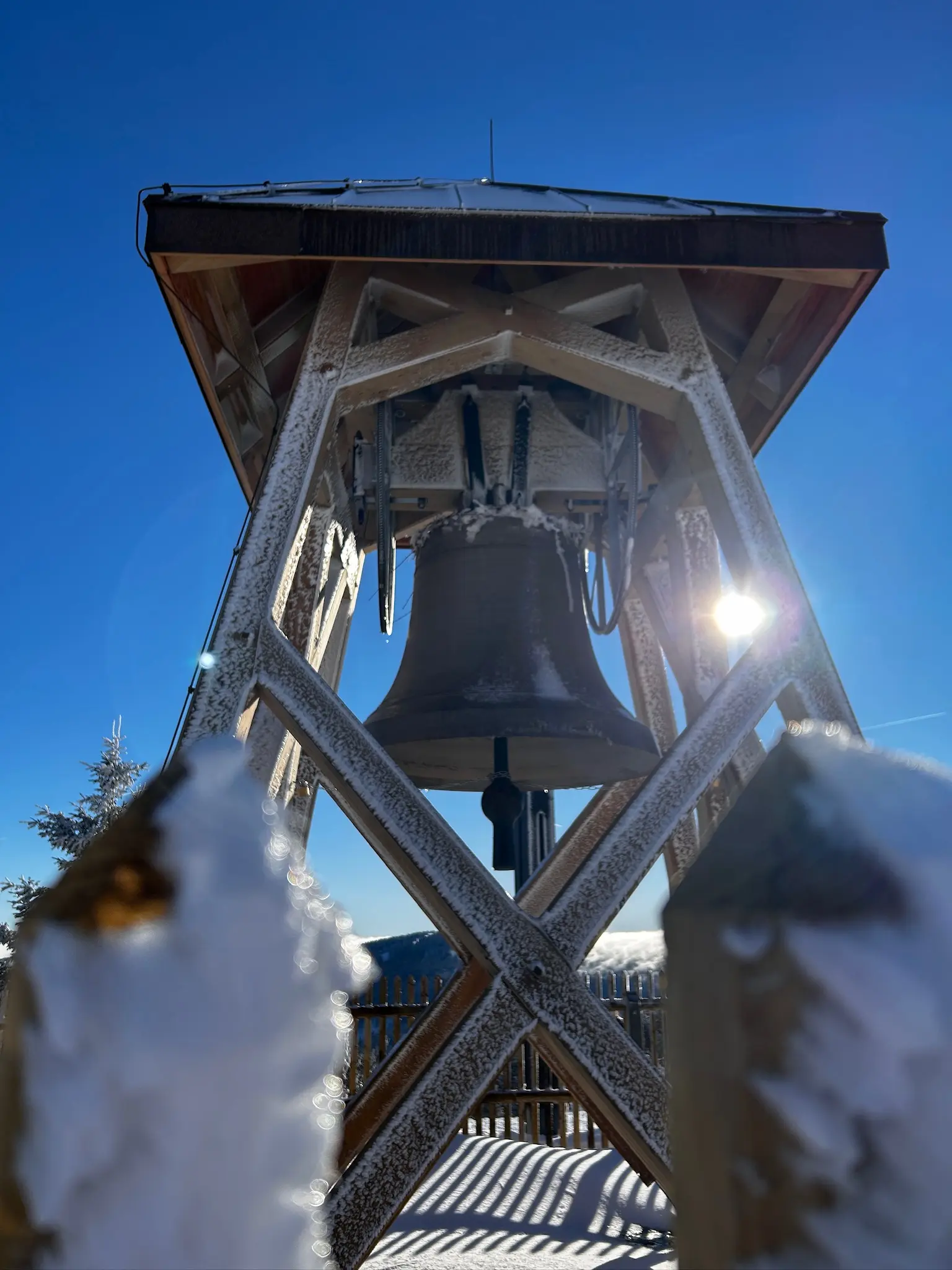
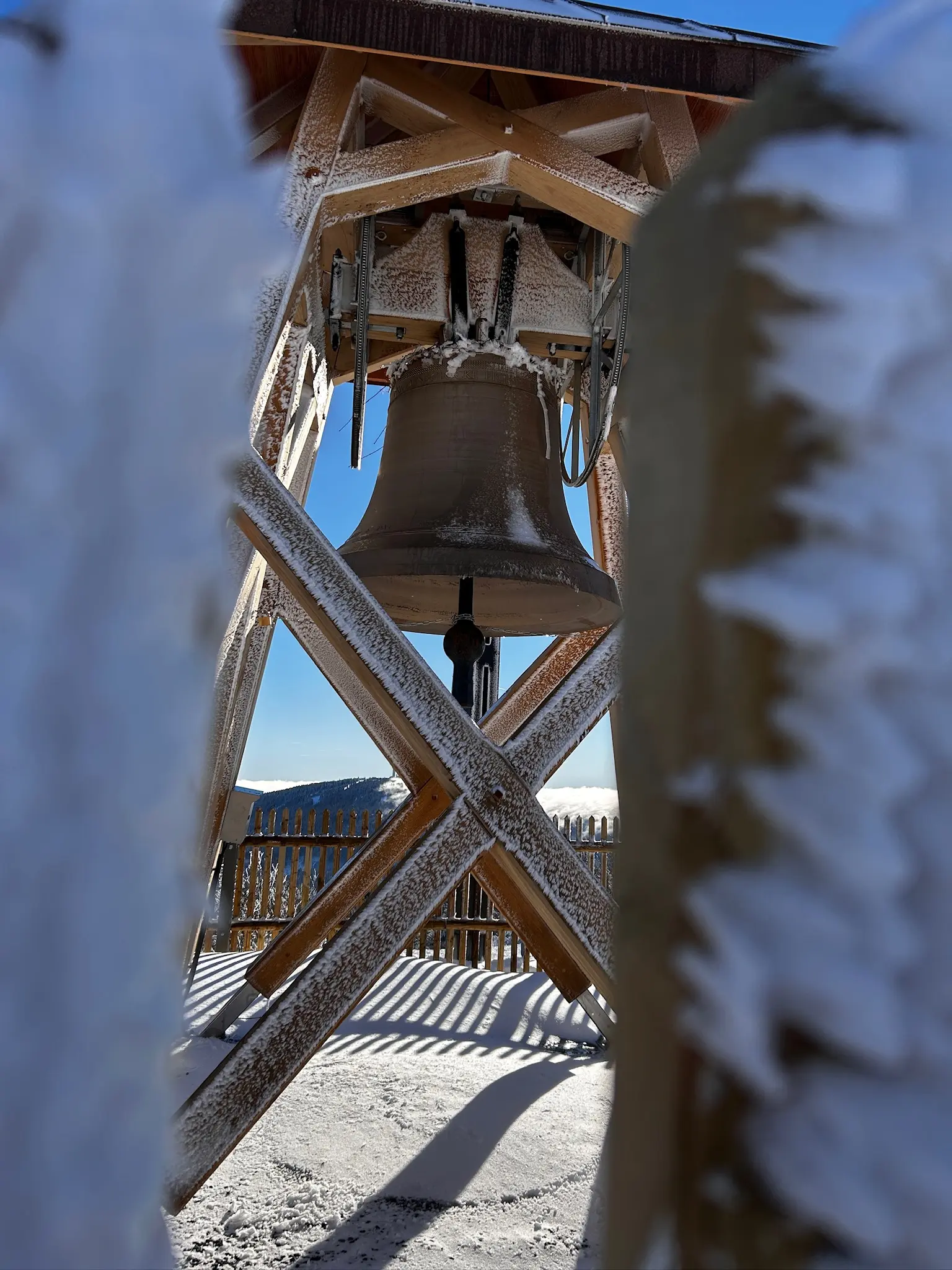
The bell is called Agnes.
She was cast in Wetzlar in 1920, weighs 1,600 kilograms and measures 1,600 millimetres across. Her strike note is D. This makes Agnes both a symbol of peace and a considerably heavier presence than her name initially suggests.
She is made from steel rather than bronze. During the world wars, many bronze bells were requisitioned for their metal and later replaced with bells of steel or iron. The organisers deliberately chose a surviving bell made from one of those substitute materials: a bell that had sounded during years of peace and could now become a messenger for it.
The idea for the Fichtelberg Peace Bell arose in 2009, as possible memorials to the Peaceful Revolution and German reunification were being discussed. Gerd Schlesinger, the tower keeper of Schwarzenberg, imagined a bell on the highest point of the former East German states.
Its voice would not stop at the German border. The bell was positioned to sound towards Klínovec on the Czech side of the Erzgebirge—a gesture towards peace, understanding and a Europe no longer divided as it had been for so much of the mountain’s modern history.
A frame was constructed from local larch, and Agnes was consecrated on 3 October 2010, the twentieth anniversary of German reunification. She normally rings at four o’clock on Sundays and public holidays, as well as on particular commemorative occasions.4
But Agnes has another history now.
In May 2022, vandals damaged her by throwing several large stones at the bell. Her sound and the length of her reverberation have been impaired ever since. An association was subsequently formed to finance a replacement bell and a new frame.5
A peace bell damaged by thrown stones is almost too exact a metaphor. History occasionally loses patience with subtlety.
Humanity has spent centuries inventing symbols of peace and almost as long testing whether they survive rocks.
Agnes remained silent during this visit, fenced away and covered in ice. Yet the silence did not make her meaningless. It made the photographs more curious: the frozen bell was no longer simply a monument to peace and reunification, but an object with a damaged voice waiting to be restored.
That changes the way the ice looks.
It is no longer merely decorative. It seems to hold the bell still.
04
What the view leaves out
Most visitors come to the Fichtelberg for the view, and the view deserves them. In clear winter light, with cloud below and blue sky above, the mountain can make the world appear enormous and perfectly arranged.
The summit itself tells a less orderly story.
A nineteenth-century stone helped surveyors measure the shape of the Earth. A modern plate gives one place two different heights. A vanished GDR building once offered six hundred people self-service meals, dancing and a view from the highest point in their country. A steel bell from 1920 now commemorates the peaceful collapse of that country—and carries damage caused by someone throwing stones.
That is a substantial amount of European history for one windy plateau. The mountain has borne it with greater composure than the Europeans.
None of these things is hidden.
They are simply small enough to walk past when the horizon is being magnificent.
Perhaps that is the trick of the Fichtelberg. It pulls the eye outwards for miles while keeping its history immediately underfoot: engraved into stone, printed in coordinates, displaced by construction and hanging silently behind a barrier.
The view tells you how far you can see.
The objects tell you where you are, who measured it, who rebuilt it—and who threw the stones.
The interesting part is usually underneath.
On the Fichtelberg it lies beneath the snow, behind the ice and somewhere inside a difference of exactly 45.83 metres.
The mountain, naturally, has declined to comment.